Why Mt. Fuji Is So Easy to See from the Shinkansen
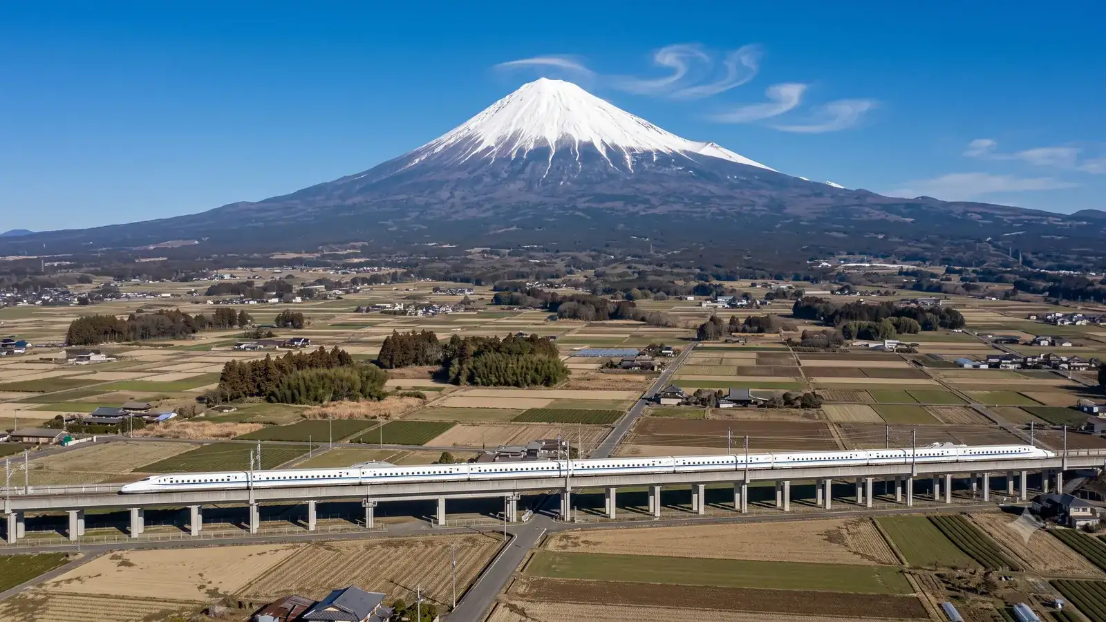
Ride the Tokaido Shinkansen and one sight dominates the window: Mt. Fuji. It is not just because the mountain is the tallest in Japan. This article uses figures from official sources to explain why Mt. Fuji is so easy to find from the train — both its terrain (the height, the free-standing profile, the enormous spread of its skirt) and the fact that the line runs along its southern foot. It also sorts out which side of the train you should sit on.
Enter your train number and see when Mt. Fuji appears→No rival in height
Mt. Fuji stands 3,776 m tall. In the list of principal mountain elevations published by the Geospatial Information Authority of Japan (GSI), its highest point, Kengamine, is 3,776 m; the second-highest peak in Japan, Mt. Kita in Yamanashi Prefecture, is 3,193 m. The gap is 583 m, and no other mountain in Japan can close it.
For spotting the mountain from a train window, though, the height itself matters less than the absence of competition. Shizuoka Prefecture describes Mt. Fuji as a free-standing stratovolcano and, at 3,776 m, Japan's highest peak — not a chain of high summits like the Southern Alps, but a mountain that rises alone. The prefecture even cites this isolation as one reason alpine plants are scarce on Fuji: because it is a free-standing peak, plants have difficulty migrating in from other high mountains. What isolation means for plants, it means for the viewer too: the outline stands up as a single mountain, never lost among connected ridgelines, and you never have to work out which summit is the one you're looking for.
A skirt so broad the whole mountain fits in view
Mt. Fuji is not a mountain that is pointed only at the top. The Japan Meteorological Agency's National Catalogue of the Active Volcanoes in Japan describes it as a stratovolcano built on top of the older Komitake and Ko-Fuji volcanoes, with a volume of about 400 cubic kilometers and a base about 50 km in diameter, carrying roughly 100 flank cones. In other words, a 3,776 m cone sitting on a pedestal 50 km across.
That ratio is what makes the mountain unmistakable from far away. Shizuoka Prefecture describes how the slope steepens as the altitude rises, drawing a beautiful cone, and how on the south side the foot of the mountain reaches the shore of Suruga Bay, so that the slope runs unbroken from the sea surface to the summit. Because the left-and-right spread of the skirt fits into your view, the outline tells you the mountain is there even when the summit is hidden in cloud.
The vertical range is just as extreme. According to a statistics column published by Shizuoka Prefecture, Suruga Bay reaches a depth of 2,500 m — the deepest in Japan — against Mt. Fuji's 3,776 m, a combined difference of 6,200 m. Japan's deepest sea and Japan's highest mountain sit side by side, joined by one continuous slope from sea surface to summit.
The Tokaido Shinkansen runs on Mt. Fuji's own skirt
This is where the route comes in. Fuji City, home of Shin-Fuji Station, describes itself as lying in eastern Shizuoka Prefecture on the southern foot of Mt. Fuji. City documents note that from its 10 km coastline on Suruga Bay to the city's northern edge directly below the summit, the elevation difference is about 3,680 m, and that it is the only city in Japan whose territory runs from the coastline all the way up to Mt. Fuji. The eastern and northern parts of the city are slopes built by the Fuji and Ashitaka volcanoes, tilting gently toward the south.
The Shinkansen runs east–west across the lowest part of that slope, on the plain near the sea. It is not passing at some distance from the mountain; it is cutting across Mt. Fuji's own skirt. And on that plain in Fuji City, no high terrain interrupts the line of sight between the sea side and the summit.
The east side is a different story. South of Mt. Fuji lies Mt. Ashitaka, whose highest peak, Mt. Echizen-dake, stands at 1,504 m in GSI's list — 2,272 m lower than Fuji. Low as it is, from the Suruga Bay side it lies much closer to you than Fuji does. The city of Numazu notes that from Mt. Kanuki, in the city, you can see Mt. Fuji over Mt. Ashitaka on a clear day. Around Mishima and Numazu, Mt. Fuji stands behind this massif and the lower part of its skirt is hidden; the full sea-to-summit profile appears only after you pass Ashitaka and enter the Fuji City side.
JR Central lists two sections where Mt. Fuji can be seen from the train: between Shin-Yokohama and Odawara, and between Mishima and Shin-Fuji. Of these, it is the Mishima–Shin-Fuji section that runs along the southern foot. The closer the train gets, the larger the mountain looks — though buildings and sound barriers near the track can cut off the lower part. How the view differs by section is covered in Where Mt. Fuji looks biggest from the Shinkansen.
The area that can see Fuji is larger than you might think
The zone from which Mt. Fuji is visible extends far beyond the rail corridor. According to Shizuoka Prefecture, the most distant confirmed viewpoint is Mt. Myoho in Nachikatsuura, Wakayama Prefecture, 322.6 km away. Calculating the theoretical visibility range from elevation data puts the northern limit in Fukushima Prefecture, the southern limit at Hachijojima and the eastern limit in Chiba Prefecture. A visibility map based on GSI elevation data can be browsed on the Japan Map Center's "Fujisan Koko" site.
Shizuoka Prefecture itself cautions that these are theoretical values, and that man-made structures may block the view in practice. Weather is an even bigger wall: JR Central writes that the mountain shows itself only when conditions line up, such as on clear winter days when the air is crisp. In fact, Fuji City checks by eye from its city hall three times a day — at 8:00, 12:00 and 16:00 — whether Mt. Fuji is visible, and the records show the visible rate runs high from autumn through spring and low in summer. Seasonal and time-of-day differences are covered in detail in How often Mt. Fuji is actually visible.
Which side of the train should you sit on?
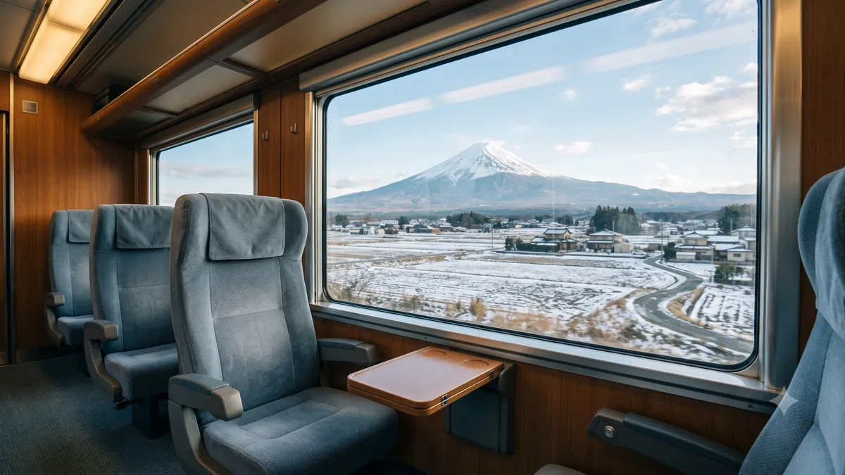
One fact settles the seat question: the line passes along the south side of Mt. Fuji. Heading east toward Tokyo, the mountain is on the left side in the direction of travel; heading west toward Hakata, it is on the right.
The seat letter, on the other hand, is the same in both directions. JR Central advises that if you take seat E, up train or down, you will see Mt. Fuji from the window. Ordinary cars have five seats per row in a 3+2 layout, and window seat E is on the Fuji side. For Green Cars, JR Central Tours notes that seat E — or seat D in Green Cars — is the Mt. Fuji side. Remember the seat letter rather than the compass direction and you won't get it wrong.
There are exceptions. According to JR Central, part of the line between Shizuoka and Kakegawa runs north–south, so "Hidari-Fuji" — Mt. Fuji appearing on the seat-A side — can occur there. The seat question in full — including why the letter never flips on the return trip — is covered in Seat E or seat A? Which side of the Shinkansen faces Mt. Fuji.
The viewing window itself is not long. That is why it pays to know in advance roughly when to turn your attention to the window. Enter your train number on Mt. Fuji from the Shinkansen (the time calculator) and you get approximate times for when the mountain comes into view, peaks and disappears. These are estimated times, derived mechanically from the timetable and the geometry of the line — they do not account for delays or weather, and on some days the mountain simply does not show. Still, waiting with a plan beats gazing vaguely out of the window and hoping.
Sources
- GSI, "Elevations of Principal Mountains in Japan (1,003 peaks)" (in Japanese) — Mt. Fuji (Kengamine) 3,776 m; Mt. Kita 3,193 m; Mt. Ashitaka (Echizen-dake) 1,504 m
- Japan Meteorological Agency, "National Catalogue of the Active Volcanoes in Japan (4th ed.), 55. Fujisan" (PDF, in Japanese) — stratovolcano; volume about 400 km³; base about 50 km in diameter; roughly 100 flank volcanoes
- Shizuoka Prefecture, "The Culture and Nature of Mt. Fuji" (in Japanese) — free-standing stratovolcano; conical form; unbroken slope from the sea to the summit
- Shizuoka Prefecture, "Naruhodo!? Mt. Fuji" (in Japanese) — Mt. Myoho at 322.6 km; theoretical visibility range; isolation and alpine plants; Fuji City's visual observations
- Shizuoka Prefecture statistics, "Japan's Highest Mt. Fuji and Suruga Bay" (PDF, in Japanese) — Suruga Bay 2,500 m deep; 6,200 m of combined relief
- Fuji City, "Chapter 1: Overview of Fuji City" (PDF, in Japanese) — southern foot of Mt. Fuji; about 3,680 m of elevation difference; the only city spanning from the coastline to Mt. Fuji; Shin-Fuji Station
- JR Central, "Going to Mt. Fuji? Take the Shinkansen — seats and travel times" (in Japanese) — viewing sections; row E; Hidari-Fuji; weather conditions
- JR Central Tours, "Complete Guide to Choosing Seats on the Tokaido Shinkansen" (in Japanese) — ordinary cars seat 3 (ABC) + 2 (DE) per row; seat E (D in Green Cars) faces Mt. Fuji
- Numazu City Tourism Strategy Division, "Numazu Tourism Portal: Mt. Kanuki" (in Japanese) — view of Mt. Fuji over Mt. Ashitaka
- Japan Map Center, "Fujisan Koko" (Mt. Fuji visibility map, in Japanese) — visibility map based on GSI's digital elevation model
All illustrations on this page are AI-generated images, not photographs of the actual scenery.