What Cap Clouds and Lenticular Clouds Tell You About Mt. Fuji's Weather
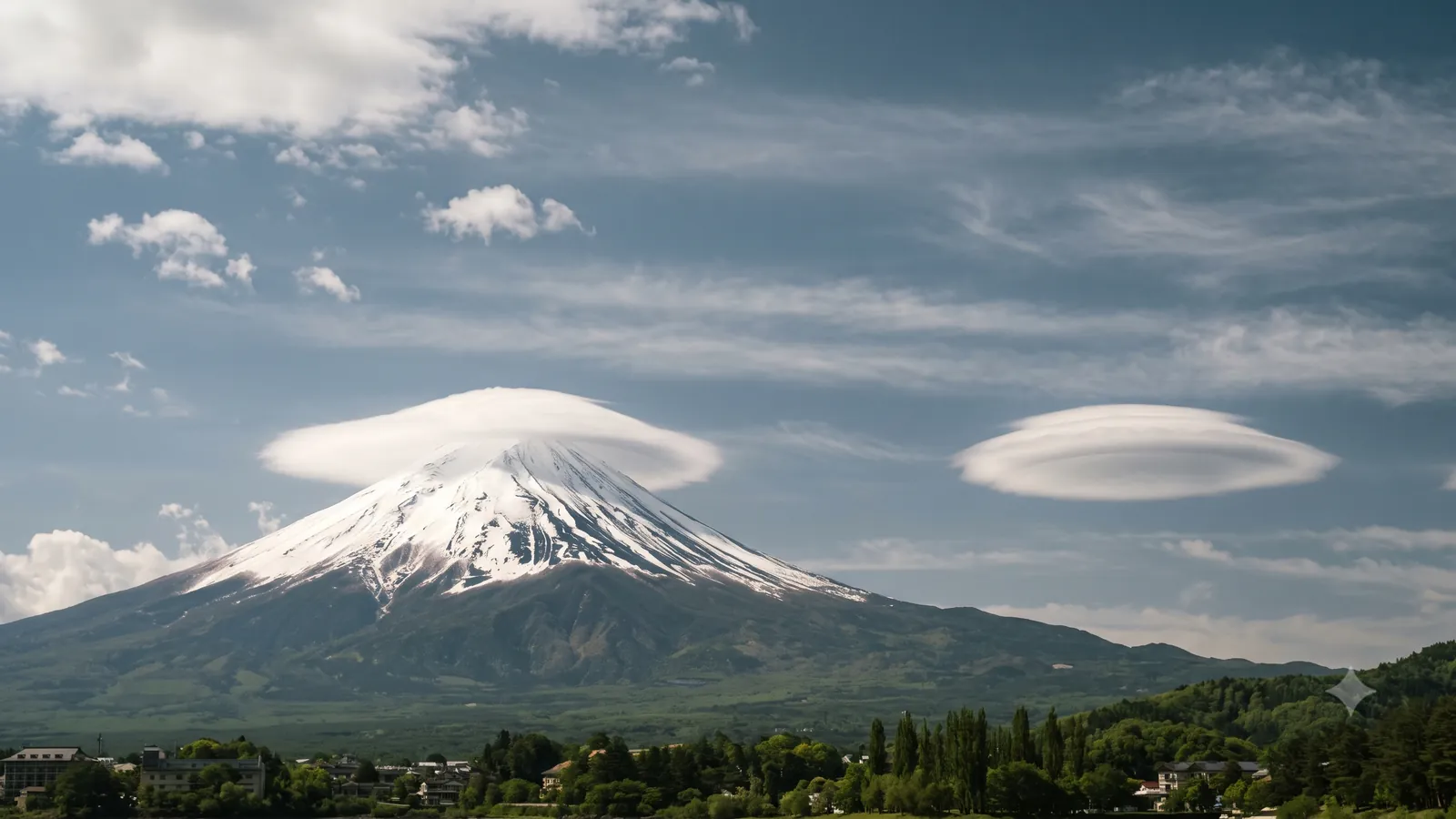
A cloud that sits on Mt. Fuji's head like a woven hat, and a lens-shaped cloud floating in the sky a little way off. Both appear when moist air strikes Mt. Fuji, but they do not form the same way. This article checks how each works — the kasagumo (cap cloud) and the tsurushigumo (lenticular "hanging cloud") — how to tell the two apart, and how far the saying "when Fuji wears its cap, rain is near" actually holds, using official sources and an observational study published in 2025. It also explains what you can read from them when they appear in the train window.
Enter your train number and see when Mt. Fuji appears→They appear when moist air strikes a solitary peak
The Fuji Sabo Office of MLIT's Chubu Regional Development Bureau explains why clouds form on Mt. Fuji: because it is a solitary peak, wind laden with moisture strikes the mountain directly, and as the air gains altitude, clouds of many shapes appear.
The wave that air sets up as it crosses a mountain is called a mountain wave. The JMA's Tokyo Aviation Weather Service Center defines mountain waves as waves that form downwind when strong winds cross a mountain, and notes their influence can extend 100–200 km downwind. In Japan they frequently form in the lee of Mt. Fuji among others, and when the air is humid, roll- or lens-shaped clouds make the waves visible. The flip side: if the air is dry, the wave may be there but no cloud appears.
According to the University of Tsukuba study described below, mountain waves are the main driver of the tsurushigumo; for the cap cloud, what matters is the height of the moist layer. Two "Mt. Fuji clouds," two different origins.
The same mechanism explains why a cap cloud seems pinned in place. The Fuji Sabo Office notes that when a cap cloud is present the wind over the summit is actually strong: cloud forms continuously on the windward slope and its droplets evaporate on the leeward slope, and this ceaseless turnover is why the cloud looks unchanged.
The cap cloud sits over the summit; the hanging cloud floats downwind
By the University of Tsukuba's glossary, the kasagumo is named for making the mountain look like it is wearing a kasa (a woven hat); the type that covers the summit is called a "contact cap," and the type that forms separated above the summit a "detached cap." So even a cap cloud does not necessarily touch the mountain.
The tsurushigumo is a kind of lenticular (convex-lens-shaped) cloud, named because it looks suspended from the sky, and comes in wing-shaped and elliptical forms. The Fuji Sabo Office describes it as cloud created in Mt. Fuji's lee by the airflow that has passed the summit.
To tell them apart, check whether the cloud is directly above the summit. Contact or detached, a cap cloud sits over the summit; a hanging cloud floats alone in the sky displaced horizontally, on the downwind side. The boundary between a detached cap and a hanging cloud is admittedly blurry, and no official source draws a line that says where one ends and the other begins.
The distinction was backed by observation in a University of Tsukuba study published in the journal Weather on October 30, 2025. A network of live cameras surrounding the mountain (four existing, three newly installed) recorded the three years from January 2019 to December 2021, with the clouds classified by eye. The dominant types were the contact cap among cap clouds and the elliptical form among hanging clouds. Cap clouds appeared mainly on warm-season mornings with fairly strong west-southwest winds and a moist layer near or above summit height — and whether a cap makes contact or stays detached is almost entirely decided by the height of that moist layer. Hanging clouds also favored southwest-wind days, but with the moist layer somewhat higher and less change of wind with height (vertical shear). The conclusion mentioned above — that mountain waves are the hanging cloud's main driver — comes from this same analysis.
"A capped Fuji means rain" is folklore — with a real basis
The Fuji Sabo Office notes that the clouds on Mt. Fuji have long served as indicators for kanten-boki, which it defines as predicting the weather by observing the state of the atmosphere — clouds, wind and so on. Local sayings survive at the foot of the mountain: "when Fuji wears its cap, rain comes soon"; "one cap means rain, a double cap means wind and rain."
The same office gives the probability of rain within 24 hours after a cap cloud appears as roughly 70% in spring and autumn, 75% in summer and 70% in winter — rising to about 80–85% when a cap cloud and a hanging cloud appear together. The stated source is material from the Gotemba base office of the Mt. Fuji Weather Station, but no observation period or number of days is given, so read the figures with that discount.
Why the folklore works is clear enough. The office explains that cap clouds form when a low-pressure system or front approaches and warm, moist air flows over the Japanese archipelago — so the weather deteriorates. The cap cloud does not bring the rain; Mt. Fuji simply renders visible, ahead of time, the influx of moist air that will.
But a cap cloud does not guarantee rain. Fuji City sorts the caps into four families — fair-weather clouds, rain clouds, wind-strengthening clouds and storm clouds — and the fair-weather side alone has five kinds. For example: "the detached cap appears on clear, windy days; the cold sharpens and fine weather continues." On the rain side there is "the single cap, appearing when a low passes along the southern coast, bringing rain," and on the storm side "the lens cap, appearing in the strong westerlies of a Japan Sea low, often followed by strong wind and rain." Every one of those pages carries Fuji City's note that cloud names vary by tradition and that no guarantee is made about the relation between clouds and weather.
If you spot one from the train
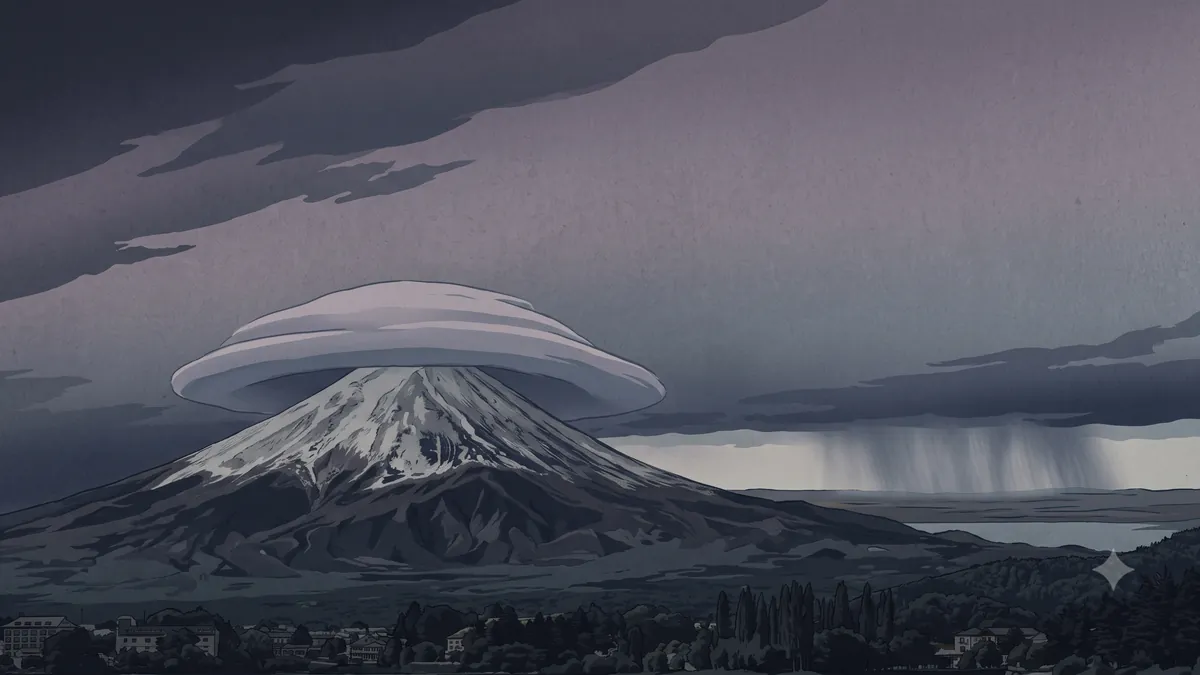
If you see a cap cloud from the Shinkansen window, the practical reading is modest: moist air has moved in aloft, and the weather may be heading downhill.
One thing is certain: with a contact cap, the summit is inside the cloud — clear skies at ground level or not, you will not see the top. That Fuji City's fixed-point observations use three categories — fully visible, partly visible, not visible at all — reflects just how many days the mountain shows only partway (How often Mt. Fuji is actually visible).
To hunt for a hanging cloud, look downwind. Following the Tsukuba finding that cap- and hanging-cloud days usually carry west-southwest to southwest winds aloft, downwind is roughly east to northeast. Since the line runs south of the mountain, that puts the cloud floating apart to the right of the summit — the eastern sky. Wind direction changes day to day, though. As for which side to sit on, it is as described in Why Mt. Fuji is so easy to see from the Shinkansen: left side heading to Tokyo, right side heading west.
If you want the shot, shoot first
As subjects, cap and hanging clouds are more capricious than the mountain itself. A cap cloud looks static while clouds are being born and dying inside it, so its outline and thickness shift by the minute. Hanging clouds are observed about once a month on average, lasting anywhere from a few minutes down to seconds, writes the Fuji Sabo Office (like the hit rates above, no observation conditions are given, so treat the frequency as a rough guide).
By this site's calculation, Mt. Fuji stays in the train window for roughly five to six minutes from first view to last — an estimate, since Shin-Fuji, which Nozomi and Hikari pass through, has no official passing time. You would be aiming, inside a several-minute window, at a cloud that may vanish in minutes. Securing one frame before perfecting the composition is the surer play. Technique is covered in How to photograph Mt. Fuji from the Shinkansen window.
For what the sky over Mt. Fuji is doing right now, the weather card on Mt. Fuji from the Shinkansen (the time calculator) shows cloud cover near Fuji City. Cloud cover alone cannot tell you whether a cap cloud is up there — but whether there is cloud at all, you can know before you board.
Sources
- MLIT Chubu Regional Development Bureau, Fuji Sabo Office, "5. Mt. Fuji's Clouds and the Weather" (in Japanese) — solitary peak and cloud formation; definition of kanten-boki; the sayings; rain-within-24-hours rates (spring/autumn c. 70%, summer c. 75%, winter c. 70%; c. 80–85% with both clouds); the cap cloud's turnover; lows/fronts and warm moist air; hanging clouds about once a month, minutes to seconds. Source credited to the Gotemba base office of the Mt. Fuji Weather Station
- JMA Tokyo Aviation Weather Service Center, "Haneda Airport WEATHER TOPICS No. 14: On Mountain Waves" (in Japanese) — definition of mountain waves; 100–200 km downwind; occurrence in the lee of Mt. Fuji and others; roll/lens clouds reveal them when the air is humid
- University of Tsukuba, "Scientific Clarification of the Frequency and Conditions of Characteristic Clouds around Mt. Fuji" (Nov 25, 2025; in Japanese) — contact cap and elliptical types dominant; mountain waves as the hanging cloud's main driver, with little contribution from flow converging after rounding the mountain; published in Weather, Oct 30, 2025
- Same press release, full text (PDF, in Japanese) — live-camera network (4 existing + 3 new) observing Jan 2019–Dec 2021; cap clouds on warm-season mornings with fairly strong WSW winds and a moist layer near/above summit height; contact vs. detached decided by moist-layer height; hanging clouds with a somewhat higher moist layer and small vertical shear; glossary (cap cloud = contact/detached; hanging cloud = a lenticular type, wing-shaped/elliptical; mountain waves)
- Fuji City, "Fair-Weather Clouds" (in Japanese) — tsumi-gasa, maekake-gasa, fukidashi-gasa, hanare-gasa, midare-gasa; disclaimer
- Fuji City, "Rain Clouds" (in Japanese) — nikai-gasa, hafu-gasa, hitotsu-gasa, ohiki-gasa, tosaka-gasa, hisashi-gasa, ware-gasa; disclaimer
- Fuji City, "Wind-Strengthening Clouds" (in Japanese) — uneri-gasa, uzu-gasa, suehiro-gasa; disclaimer
- Fuji City, "Storm Clouds" (in Japanese) — lens-gasa, yokosuji-gasa, kaimaki-gasa, ento-gasa, nami-gasa; disclaimer
All illustrations on this page are AI-generated images, not photographs of the actual scenery.