Mt. Fuji the Active Volcano, and the Hoei Eruption of 1707
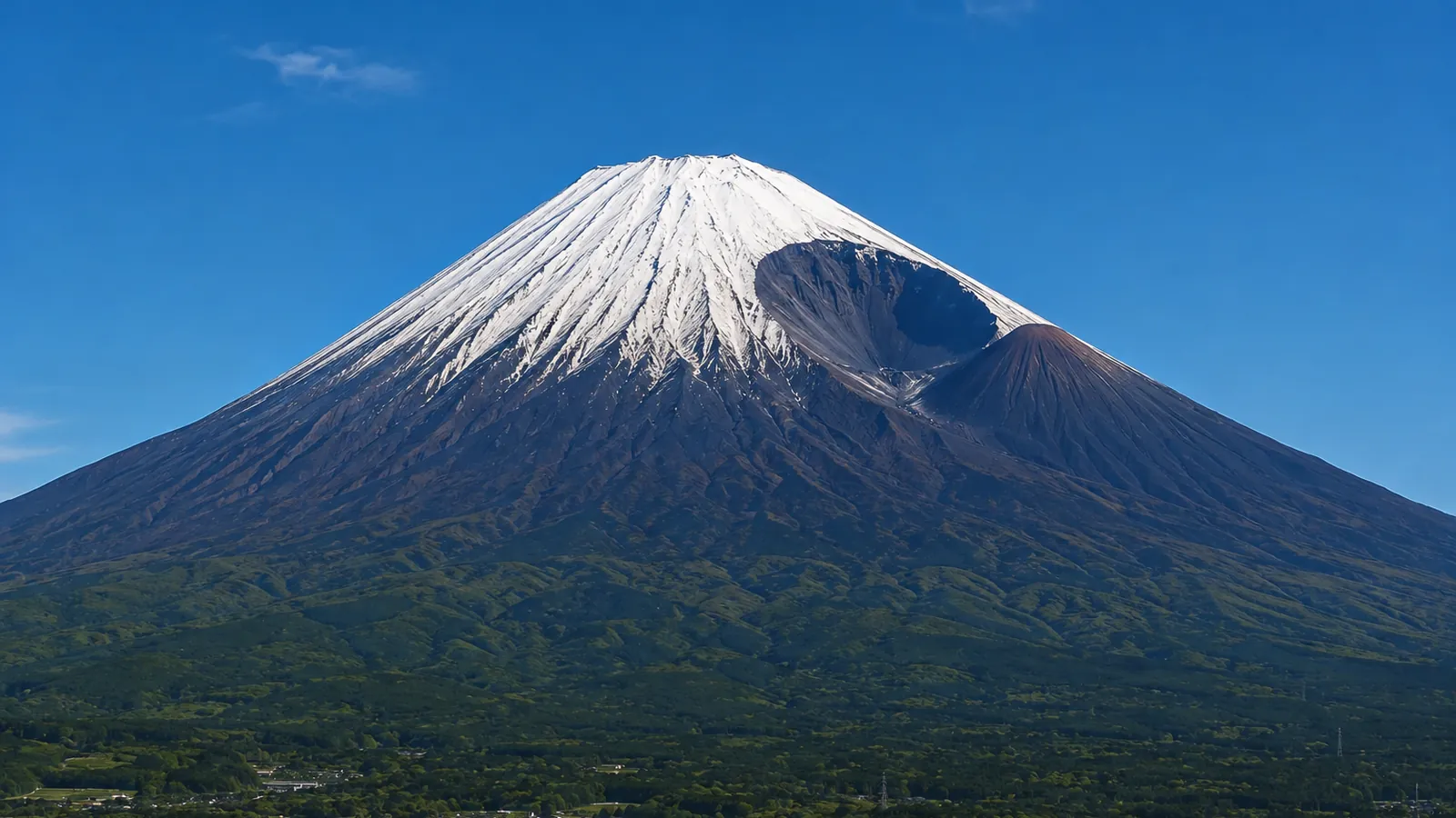
Mt. Fuji is an active volcano. Its last eruption came in 1707, and the ash it dropped piled up as far away as Edo — today's Tokyo. This article covers, within the bounds of what official sources confirm, how the Japan Meteorological Agency monitors the mountain, what happened in the Hoei eruption, where the Hoei Crater that eruption left can be seen from, and how the current hazard map and evacuation plan stand.
Enter your train number and see when Mt. Fuji appears→"Active volcano" does not mean "dangerous"
The JMA defines an active volcano as one that has erupted within roughly the past 10,000 years or currently shows active fumarolic activity. There are 111 volcanoes in Japan that meet the definition, and Mt. Fuji is one of them (JMA). The yardstick is 10,000 years long, so "active volcano" does not mean "a mountain that could blow at any moment."
Of the 111, 51 volcanoes are monitored around the clock, equipped with seismometers, tiltmeters, infrasound meters, GNSS receivers and surveillance cameras to catch precursors of eruption (JMA). Mt. Fuji is among these constantly monitored volcanoes (JMA).
At present Mt. Fuji stands at Eruption Forecast (Volcanic Alert Level 1: "be aware that this is an active volcano"), and the JMA reports that volcanic activity remains calm, with no signs of an eruption (JMA). The Volcanic Alert Level is an index announced on a five-step scale that pairs the area requiring caution with the disaster response expected of agencies and residents; Level 1 is the lowest step (JMA).
In the Hoei eruption, ash fell on Edo
The Cabinet Office's Central Disaster Management Council report "The 1707 Hoei Eruption of Mt. Fuji" gives the eruption's span as December 16, 1707 to January 1, 1708 (the 23rd day of the 11th month to the 9th day of the 12th month of Hoei 4 in the old calendar) (Cabinet Office disaster summary sheet).
By the JMA's records, an explosion opened on the southeast flank on the morning of December 16, accompanied by black smoke, ballistic stones, air shocks, falling ash and sand, and lightning. The ash reached Edo in quantity the same day, and at Kawasaki it piled 5 cm deep (JMA, National Catalogue of the Active Volcanoes).
The Cabinet Office's summary sheet records that while no direct deaths are documented among the primary damage, the falling pyroclastic material collapsed buildings, made farmland impossible to cultivate, and damaged forests and roads. In the village of Subashiri, 75 houses collapsed.
That does not mean no one died. The eruption continued intermittently until the month's end, and the JMA catalogue records many deaths by starvation in villages where houses and farmland lay buried. Nor did the damage end there: the fallen ash washed out with every rain, driving repeated floods and debris flows, and in the Ashigara plain along the Sakawa River the secondary disasters continued for nearly a century.
This scale, however, is not standard for Mt. Fuji. The same report writes that a large, explosive eruption like Hoei is, if anything, a rare event in the mountain's eruptive history (Cabinet Office, "Conclusion").
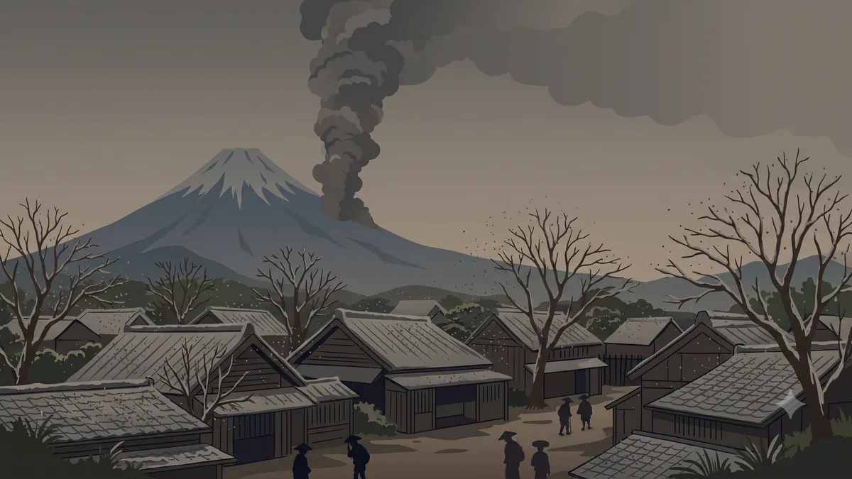
Forty-nine days before the eruption, a great earthquake
On October 28, 1707, the Hoei Tokai–Nankai earthquake struck. Mt. Fuji erupted 49 days later. The Cabinet Office report states that the Hoei eruption is thought to have been triggered by that earthquake (Cabinet Office, "Conclusion").
The same report is equally explicit, though, that no simple rule of "great earthquake nearby, then immediate eruption" necessarily holds.
There were precursors. By the JMA's records, seismic activity felt only on the mountain itself began one to two months before the eruption, intensified from about two weeks out, and by the day before, felt earthquakes were increasing at the foot of the mountain as well (the largest around magnitude 5; JMA catalogue).
The Hoei Crater faces south
Mt. Hoei, built by the eruption, is Mt. Fuji's largest and newest flank volcano, its summit standing at 2,693 m (Ministry of the Environment, Kanto office).
The Ministry of the Environment's Numazu ranger office, explaining how to tell where a photograph of Mt. Fuji was taken from, notes that in views from the south the Hoei Crater and Mt. Hoei are the tell-tale marks, recognizable from Fuji City and Kannami Town (and adds that from Numazu the view is blocked by Mt. Ashitaka).
The Tokaido Shinkansen's closest approach to the mountain is exactly that stretch through Fuji City (Where Mt. Fuji looks biggest from the Shinkansen). What you see from the window, then, is the southern slope where the Hoei Crater sits. Note that the ministry's material goes only as far as saying the crater is a landmark from Fuji City; it says nothing about whether it can be picked out from a moving train.
The hazard map was revised in 2021
On March 26, 2021, the Mt. Fuji Volcanic Disaster Management Council revised the Mt. Fuji hazard map. Since the 2004 edition, research had accumulated new knowledge of the eruption history, raising the need to rework the damage assumptions for vent locations and eruption volumes; the council decided on the redo in 2018 and took about three years (Shizuoka Prefecture). Alongside newly discovered vents, the entire area within a 4 km radius of the summit was added as potential "concealed vents" buried underground, widening the assumed vent zone. The eruption period considered was also extended, from "about 3,200 years ago to the present" to "about 5,600 years ago to the present" (Mt. Fuji Volcanic Disaster Management Council).
By the same document, about 180 eruptions have been confirmed over the past 5,600 years, 96 percent of them small or medium. No firm evidence of an eruption has been confirmed in the 300-plus years since Hoei in 1707 — and yet, it states plainly, the next eruption will not necessarily be one of the frequent small or medium events; a rarer large eruption is also possible.
The new assumptions place potential vents near the built-up areas of Fujiyoshida and Fujinomiya, drastically shortening the projected time for lava flows to reach town. Seven cities and five towns, including some in Kanagawa Prefecture, were newly added to the volcanic disaster alert area. In response, the council renamed the old wide-area evacuation plan the "Mt. Fuji Volcanic Evacuation Basic Plan," revised it, and published it on March 29, 2023 — built on the principle of putting life-protecting evacuation first while giving the greatest possible weight to protecting livelihoods (Shizuoka Prefecture).
How to take this as a passenger
Mt. Fuji's activity today is calm, and the JMA watches it around the clock. As a worry for the minutes you spend passing on the Shinkansen, it is not a realistic one.
But neither the JMA nor the Cabinet Office goes so far as to say monitoring guarantees advance warning. The JMA's caveats on alert levels note that eruptions can occur without any observed anomaly, and that level announcements do not necessarily proceed step by step in order; the Cabinet Office report closes by warning that small eruptions may well show no observable precursors, and that disaster preparedness must not rely on prediction alone. If you plan to climb, check the JMA's volcanic warnings and forecasts before setting out.
With that in mind, looking for the Hoei Crater from the train changes how the mountain reads. The tidy cone is not a finished sculpture but a work in progress, rewritten with every eruption. Check your approximate passing time on Mt. Fuji from the Shinkansen (the time calculator) and you will have the spare seconds to hunt for the crater once the mountain fills the window (the displayed times are estimates). How the mountain became a World Cultural Heritage site is covered in Why Mt. Fuji is a World Cultural Heritage site.
Sources
- JMA, "What Is an Active Volcano?" (in Japanese) — definition: erupted within roughly the past 10,000 years or currently active fumarolic activity; 111 active volcanoes in Japan
- JMA, "Volcano Monitoring" (in Japanese) — 51 of the 111 monitored 24 hours a day; instrument types
- JMA, "Explanation of Volcanic Alert Levels" (in Japanese) — the five-step index; "eruptions can occur without observed anomalies, and level announcements do not necessarily proceed in order"
- JMA, "Volcanic Activity Status (Mt. Fuji)" (in Japanese) — Eruption Forecast (Alert Level 1); "activity remains calm, with no signs of eruption"
- JMA, "National Catalogue of the Active Volcanoes in Japan (4th ed.), 55. Fujisan" (PDF, in Japanese) — constantly monitored volcano; the Dec 16, 1707 eruption on the southeast flank (Hoei Crater); heavy ashfall on Edo, 5 cm at Kawasaki; precursory seismicity from 1–2 months out and M5-class the day before; "many starved in villages where houses and farmland were buried"
- Cabinet Office, Central Disaster Management Council, report "The 1707 Hoei Eruption of Mt. Fuji" (in Japanese) — disaster summary sheet (eruption span; 75 houses collapsed in Subashiri; ashfall on Edo); "Conclusion" (triggering by the Hoei Tokai–Nankai earthquake; the earthquake–eruption relation; a century of secondary disasters in the Ashigara plain; large eruptions rare)
- Mt. Fuji Volcanic Disaster Management Council, "On the Revision of the Mt. Fuji Hazard Map" (Mar 26, 2021; PDF, in Japanese) — widened assumed vent zone and concealed vents; extended eruption period; about 180 eruptions in 5,600 years, 96% small or medium; no firm evidence of eruption in the 300+ years since Hoei
- Yamanashi Prefecture, "Mt. Fuji Hazard Map (revised March 2021)" (in Japanese) — the revised map and report
- Shizuoka Prefecture, "Mt. Fuji Volcanic Evacuation Basic Plan (March 2023)" (in Japanese) — redo decided 2018, published March 2021; 7 cities and 5 towns newly added to the alert area; plan renamed and revised, published Mar 29, 2023; life first, livelihoods weighed to the fullest
- Ministry of the Environment, Fuji-Hakone-Izu National Park Numazu ranger office, "How to Tell Where You're Seeing Mt. Fuji From" (PDF, in Japanese) — from the south, "the Hoei Crater and Mt. Hoei are the landmarks," recognizable from Fuji City and Kannami; hidden by Mt. Ashitaka from Numazu
- Ministry of the Environment, Kanto Regional Environment Office, "A Magnificent View! Climbing Mt. Hoei!" (in Japanese) — Mt. Hoei summit at 2,693 m; Mt. Fuji's largest and newest flank volcano
All illustrations on this page are AI-generated images, not photographs of the actual scenery.